The Yukon Culinary Festival

Saturday, August 2, 2014

This morning we sat in the hotel restaurant having a coffee and thinking about breakfast when one of the crew came to tell us there was a local Pancake Breakfast at the historic church a couple of blocks away. Off we went then to the old Anglican Church – now historic site – and paid our $10,00 for very tasty pancakes, sausages, orange juice and coffee. The treat to top it off was the ‘Birch Syrup’, made locally – the north’s answer to Maple Syrup. Very tasty!

I went back to the hotel at that point while others left for the Visitor Centre to pick up the walking tour around the old town. I sat there drinking coffee and got a few more blog entries done before I was to join one of the walking tours at 1pm. This was a wonderful tour lead by a local woman, Sue, who had been in Dawson City since her late teens and was now in her early sixties probably. She gave a wonderful and candid tour of the town and gave us her own private thoughts on the reality TV shows about Yukon Gold. I’m not sure it was from Parks Canada’s talking notes, but I think she was on to something when she drew out the contrast between those TV shows personalities with nothing to risk and the local families who still mine for gold in the area.

DSCN4502.JPG

Our Walking Tour Guide – Sue.

IMG_0341.JPG

One of the sites on our Walking Tour.

After that tour we drove out to another historic site – Dredge No. 4. This piece of mega machinery began working the local creeks in about 1913 and had ‘eaten’ its way about 5km up the creeks into the hills before it was abandoned in the late 1950s. I think ultimately pulled something like 800 metric tons of gold from the creek beds in the area. The tour guide was funny and knowledgable and it was worth the $15 charge.

DSCN4504.JPG

Now this machine could certainly be on one of those ‘Mega Machine’ TV shows.

DSCN4505.JPG

How the dredge works.

Back at the hotel, someone had found out about a finale dinner for the Yukon Culinary Festival to be held that night at the historic Commissioners residence. For $40 we bought our tickets and strolled over to the mansion at 7pm. There we saw laid out before us the most succulent array of culinary delights made exclusively with local products – elk sliders, bison steak, scallops, salmon.

IMG_0329.JPG

IMG_0342.JPG

The Commissioner’s Residence in Dawson City, Yukon – a Parks Canada heritage site.

There were six chefs for this second year of the Festival – two from Toronto, one each from Whitehorse, Ketchican, Victoria, and Vancouver. Ted Reader, the famous BBQ Chef, was there as kind of a headliner. What an evening and what a way to see something of the range of agriculture etc. from the north. The general consensus was that the Bison steak was the best – it had a Saskatoon berry reduction over it!

IMG_0343.JPG

Elk slider.

IMG_0344-0.JPG

Pacific salmon.

IMG_0345.JPG

Selfie with Ted Reader.

When we left that Gala Dinner, Bob, Suzanne and I walked over to Diamond Tooth Gertie’s to watch a show and have a drink. It was a fun and rowdy show and I went to play a slot machine and doubled my $20 investment for my trouble!

IMG_0330.JPG

Me and the gals at Diamond Tooth Gertie’s.

The Dempster Highway

Friday, August 1, 2014

We had planned to be on the road by about 8am, but it was closer to 9am by the time we rolled out of town and down the first curves of the famous and wild Dempster Highway. We made it to Tsiigehtchic in good time and crossed the MacKenzie River – on the ferry this time. How odd it seemed and what a different view of the river from the ferry as opposed to seeing it by sitting three feet off the water in a voyageur canoe. At Fort MacPherson we crossed the Peel River on another ferry before climbing into the more wild reaches of this part of the Northwest Territories and the Yukon Territory.

DSCN4444.JPG

Crossing the Mackenzie River at Tsiigehtchic.

The Dempster Highway itself was a LONG drive (more than 700km of rough gravel road) and it was raining heavily for much of the way for us. Its winding path climbed its way through bare cold hills that were largely clouded and wet. Black stick-like trees jutted out of the shin-tangle that flanked each side of the road for miles into the distance. In many ways, a few of us thought the land looked like something out of a J. R. R. Tolkien novel.

DSCN4476.JPG

The mud-covered highway.

DSCN4453.JPG

Note the built up roadway on this section of the winding Dempster Highway.

We stopped for some lunch at Eagle Plains, about half the way to Dawson City – our destination for the day. With the weather conditions we faced the place looked like the windswept definition of loneliness in all that rain and fog. The lunch, on the other hand, was tasty and we did get a good look at the gallery of historical photos that line the walls.

IMG_0338.JPG

These and many other mounts adorned the walls in the lounge of the Eagle Plains Motel.

By the time we reached the Tombstone Mountain area, the weather was beginning to improve somewhat and the mountain itself was spectacular. We kept rolling down the highway as the rear driver’s side tire began to flatten on us, and we hoped we could make Dawson City without it going completely flat.

DSCN4489.JPG

Tombstone Mountain..

We did get to Dawson City without having to stop and change the tire. We offloaded the tire to a CAA rep and went to sign in at the Eldorado Hotel for two nights. That night we ate a Klondike Kate’s diner, and it was a wonderful meal by any standards. After the long driving day it was off to bed to recoup a bit for our day-off in dawson City.

Relaxation

Thursday, July 31, 2014

This was a slow day for me and for most of the rest of the crew too I suspect. After some breakfast it seemed everyone headed off in separate directions. I ended up spending a few hours sitting at the restaurant table uploading some of the blog entires. A few from the Hinton crew and Suzanne came back to say they’d arranged a flight to Tuktoyaktuk for the afternoon.

About noon I got a call from my older brother, Jim, who lived in Inuvik for 17 years and he gave me a list of friends of his to visit. Richard Wagers and I were having lunch and after we’d eaten we headed off to meet Carman Jones, who own’s the famous Mack’s News Stand on the town’s main street. Her brother and Jim’s oldest son, James, were room mates in Edmonton for a few years. Then it was off to the Town Hall to see if Floyd Rowland, the Mayor, was in. He was, and we sat in his office and chatted for about half an hour with him recounting life in the Arctic (he’s from Tuktoyaktuk) and his life as a Mayor and a past Premier of the Northwest Territories. Finally, we headed to another government building to meet Peter Clarkson, a friend of Jim’s who has trekked all over the Arctic for both personal interest and scientific study.

IMG_0359.JPG.

The famous “Igloo Church’ on Inuvik’s main street.

After dinner everyone retired to the room that Richard and I were sharing to try and distill the weeks’ paddling into what I call the The Good, The Bad, and The WOW. I recorded all those thoughts and will set them out in a separate Blog entry. Richard took over then and had set up a game a few day earlier in which each of us had to jot a note about something that no one would know about us. It went around the room a few times and was a hilarious end to getting to know each other over the last few weeks.

IMG_0337.JPG

Richard purchased a bottle of Sparkling Wine to toast the journey and to begin the evening’s stories.

We all went to bed late as one might suspect.

Pushing Back The North Wind

Wednesday, July 30th, 2014

I heard loons through the night; what a wonderful calming sound of the wilderness and the north – others commented on the serenade of the loons last night too. When we all began to roll out of our tents about 4am we were pleased to know it hadn’t rained. The mosquitos, however, did show up in numbers! Fortunately, our mosquito tent kept them somewhat at bay so our breakfast was reasonably free of them. What was more interesting and challenging with so many mosquitos hovering around was heading into the shoreline brush with a shovel and roll of toilet paper for that part of the morning routine for everyone.

This morning we were on the water by about 6:10am and heading for our final destination, Inuvik! The first two to three hours were actually fairly pleasant. As with the last few days, however, the cold north wind and rain set hard upon us as we paddled on.

DSCN4434.JPG

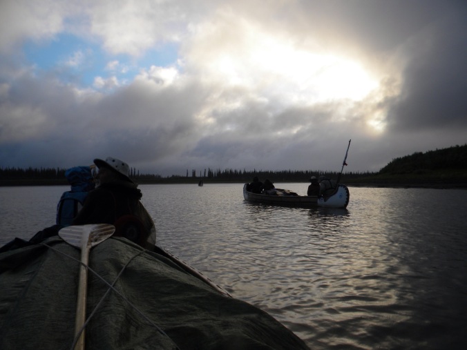
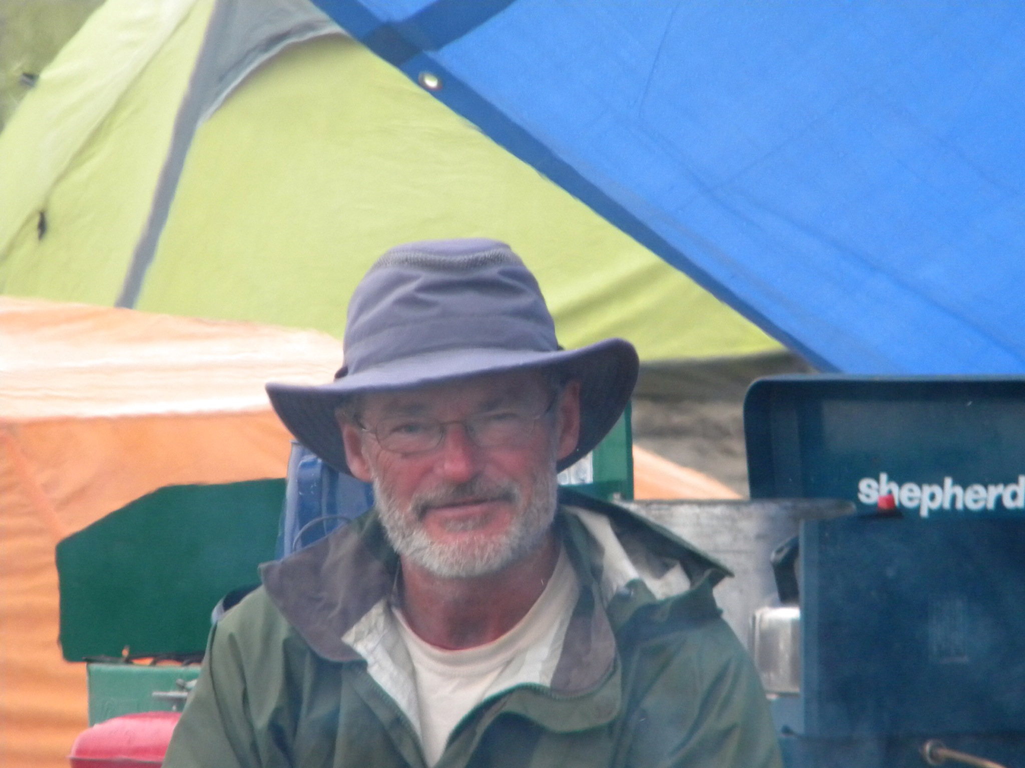
This is a typical scene from the past day’s paddle into Inuvik.

Shore breaks this morning were few and far between because the river banks in the East Channel are the consistency of Jell-o. At one point, I watched Doug try to step out of the bow of the canoe to take a shore bio-break and in a heartbeat he was up past his knee in that sludge! What breaks we did take were short because if we dallied for any amount of time there was a real risk of getting cold and that would be the beginning of things much worse to contemplate. The paddling itself was slow, both into the bitterly cold wind and because the current was getting slower and slower by the minute. At one point after a quick shore break, we were so cold I wondered if we’d have to stop to build a fire, but we caught a second wind and snuck through the potential crisis.

DSCN4433.JPG

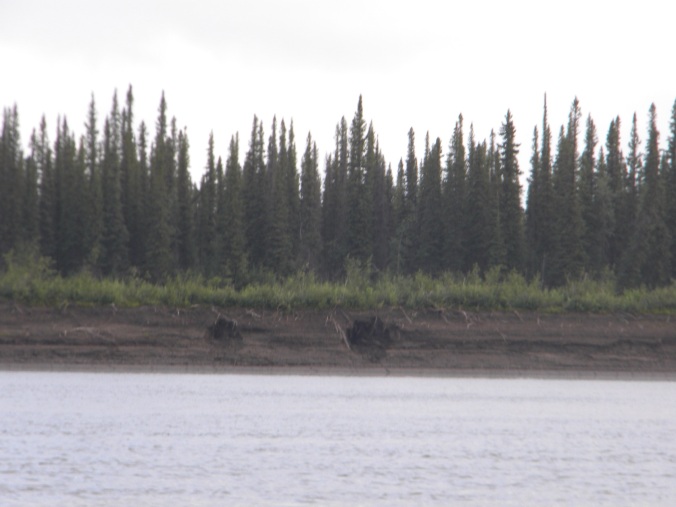
The distinctive shore line of the MacKenzie River in the East Channel of the delta.

As we neared Inuvik, we caught sight of one full grown Bald Eagle and four juveniles. I have seen a lot of Bald Eagles, but these juveniles were by far the largest specimens I have ever seen! As they glided from tree to tree along the shore, crows kept pestering them, always staying a safe distance away at the same time.

Finally, we turned the last bend in the river toward Inuvik in the distance, and the wind picked up with even more force. Later that evening Bob made a great observation that, rounding that last bend it truly looked as if we were paddling up hill because of the lay of the land and the huge waves building in front of us. The East Channel is perhaps up to 150M wide at Inuvik, but the wind was blowing straight down the river with the consequence that as we neared the town the waves were getting bigger and bigger – and we were on the wrong side of the river to land the canoes!

IMG_0318-0.JPG

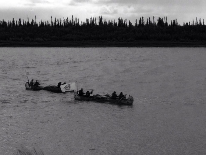
These three photos were taken by one of brandy’s friends who lives in Inuvik – Brandy had asked a number of her Inuvik friends to look for us coming into the town and there we were.

IMG_0319-0.JPG

IMG_0320-0.JPG

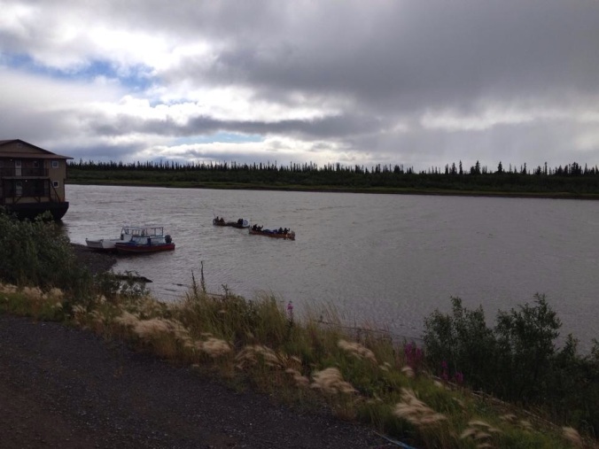
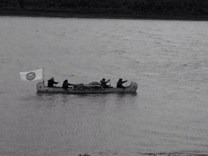
When it did come time to cross the wave-filled river, the only saving grace to the wind we faced was its direction. Coming straight on us like that, we could steer directly into the waves and ferry sideways across the channel to the boat launch. The size of these waves matched some of the bigger ones we’d seen earlier in the journey and, although we did take on water as we crashed down into the oncoming swells, it wasn’t so much we needed to worry. We made it across and pulled in just up river of a large barge holding a full work camp on its deck. Within a few minutes, the other two crews joined us. We spent a few minutes at this spot but, talking with a local fellow who came down to see us, we knew we’d have to pull into the waves again and go around the huge barge to the full boat launch about 200M downstream. So back in the canoes we went, and we could all feel the relief when we pulled into shore for this final leg of our expedition.

DSCN4435.JPG

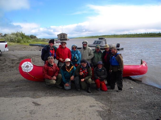
Our Mackenzie River – Dehcho Expedition 2014 crew on the banks of the river in Inuvik.

My Niece, Brandy, had arranged for us to store our trucks and boat trailers in the work yards of a local contractor she knew, Kurt Wainman. I called his cell number and he sent one of his crew to pick up our three drivers to retrieve the vehicles. We unloaded the canoes and loaded them and our gear onto the vehicles and trailers and headed to the MacKenzie Hotel on Inuvik’s Main Street for a well-deserved shower, meal (that wasn’t dehydrated) and a beverage! As were doing the loading, a vehicle pulled up and I went over to talk to the folks who were sitting all wonderfully warm tucked in their vehicle. They were from Tuktoyaktuk and had come to Inuvik by boat a few days earlier. Their local observation was that there was no way they were going to try to drive the boat home in this weather – the very weather we had just faced paddling into town!

When we got to the hotel, I’m not sure I can adequately describe how wonderful it felt to peel off my cold and wet and dirty clothes and to step into that steaming shower at the hotel. I think it took at least a two or three washings to get my hair clean!

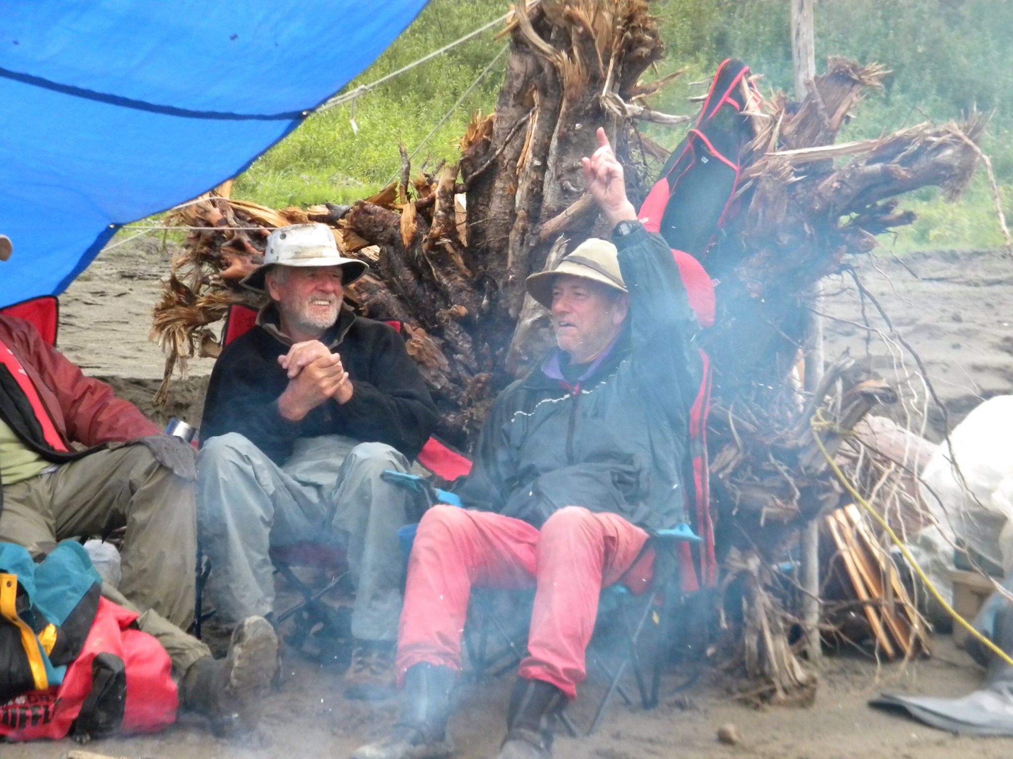
The second order of business was to meet the other expedition members in the hotel lounge for a beverage or two. One by one the entire crew sauntered in looking all clean and somewhat refreshed and tidy and certainly smelling better. The lounge also served a great dinner (Muskox Burger) so we stayed and visited for the evening and recounted so many episodic pieces of our journey over the last weeks.

IMG_0323.JPG

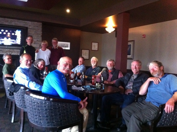
The expedition crew relaxing in the MacKenzie Hotel in Inuvik.

Rick had set up a ‘pool’ as to how many kilometres we’d travel by the end of the trip. With great ceremony he announced the final three entries who were vying for the $60 prize. In the end, Doug took the prize getting closest to the final total of 1488km. We also enjoyed what we were coming to call – Rick’s mosquito beer.

IMG_0322.JPG

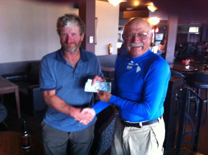
Rick presenting Doug with his winnings.

This was the final day of our river journey down Canada’s longest waterway – the mighty MacKenzie River – Dehcho. We prevailed. We were prepared. We worked very hard. We were lucky. We are all so proud of our accomplishment, and it will stand as a benchmark event in all our lives I am sure.

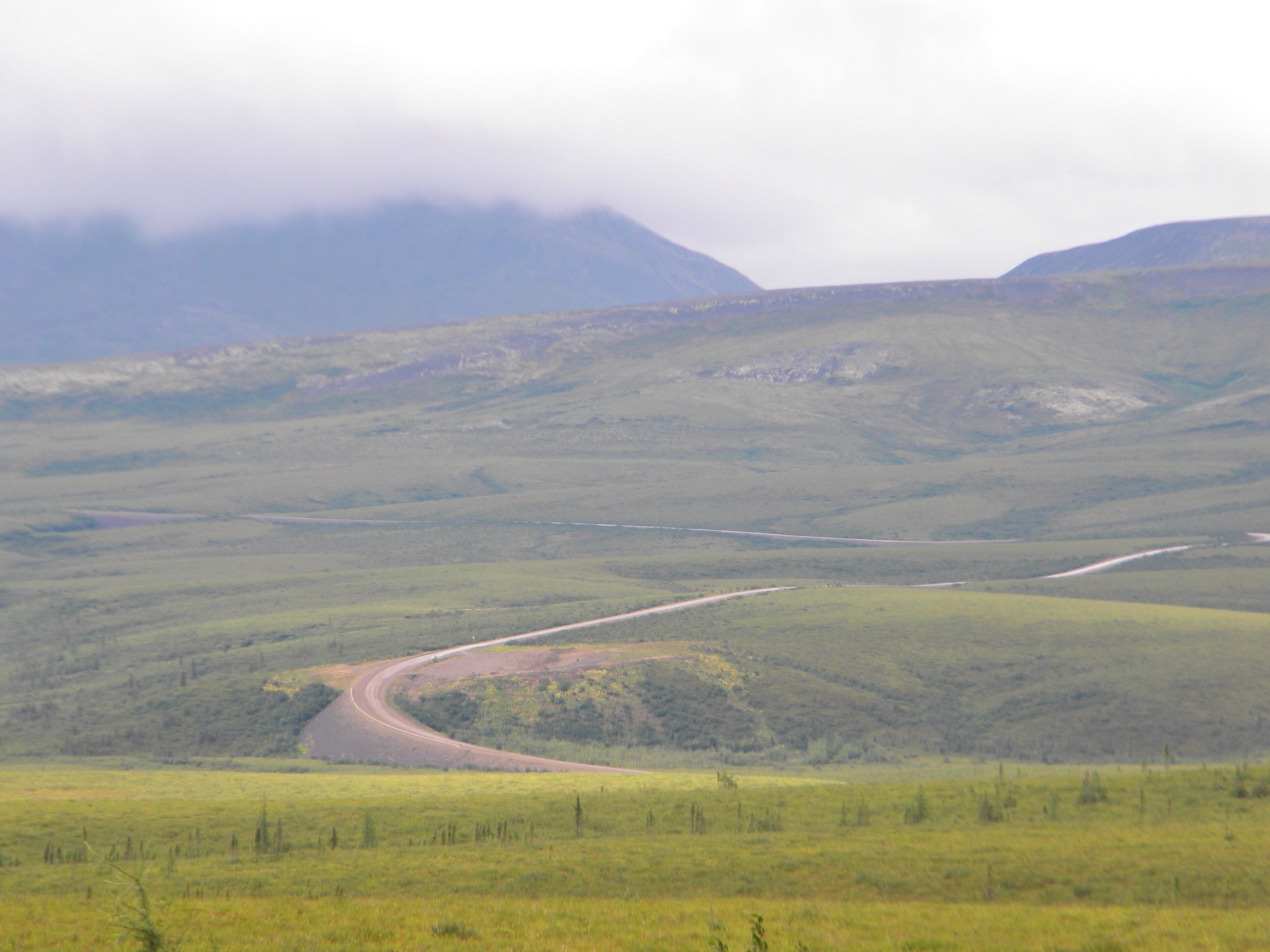
Following is the account of our trip back from Canada’s Arctic – down the Dempster Highway and eventually home.

Into The East Channel

Tuesday, July 29th, 2014

Tonight I am writing this entry from inside my sleeping bag as it is COLD and supposed to get colder.

I was out like a light last night, despite the cold, with the noise of the MacKenzie River ferry, the cackle of ravens and gulls next door near the fish drying/smoking camp, and the occasional roar of quads all night. Thankfully, it was others who told me about those noises as I was sound asleep!

We were up and on the water by about 6:20am and paddling into a light wind and cold air. What was supposed to be about a 15km paddle to the smaller ‘East Channel’ turned into about a 30km paddle into the wind and rain and mist and steam until we finally turned east. We were all soaked and cold but more prepared for it today so, though uncomfortable, our breaks were short to keep us warm and we paddled on.

DSCN4428.JPG

One of our shore breaks as we turn east at Point Separation. In the distance it is clear to see just how flat and wide and wild the landscape is.

Once into the East Channel, it was easier paddling. Even if it was windy, we could stay roughly mid-river and catch some current because the river was only a couple of hundred metres wide.

We paddled for about 72 km today until just up river from our last bend in the river to keep us in the East Channel for our final day into Inuvik. This was our campsite and, as he used to work in forestry, Rick ‘guaranteed’ us that there would be no mosquitos and put a round of beer on his reputation. Oh that beer will taste good when we get to Inuvik as, you guessed it….the mosquitos were everywhere.

DSCN4430.JPG

Our camp site in the carpet of Horse Tails on the west side of the East Channel.

We estimate it to be about 50 – 60 km to our final destination tomorrow. If we are on the water by 6am and don’t run into trouble, we should be there by early afternoon. The current is slower now and at our breaks we only have 2 – 3km per hour.

If I’ve mentioned that the landscape here is flat, it was nothing compared to the flatness of the MacKenzie delta. That said, the water is quite low and the shores generally stand tall above the water. Where there is a more shallow shoreline, these are covered with an almost fluorescent green carpet of fine-stemmed Horse Tails. These areas look so very inviting, but it is a ruse – the moment you step out of the canoe for a pee you are immediately smothered by mosquitos.

We are camped in the lee of the cold wind for the night, and all of us had a good visit tonight inside our mosquito tent. Gene brought out the last of his very special old scotch. We had a toast of this special drink at the beginning of the journey, and Gene made sure there was a dram for each of us to celebrate our last night on the river.

DSCN4432.JPG

Our mosquito tent set up and saving us from the swarms as we sip our dram of fine scotch.

The Twilight Zone

Monday, July 28th, 2014

After the kind of wet day we’d had yesterday and a good evening visit, we decided to get up and out a little later, so we were on the water by about 7:30am. The day’s paddle took us into what we were calling, The Twilight Zone. This was a section of the river that was not represented in maps in Michelle Swallow’s book, The MacKenzie River Guidebook. Somehow, this section of about 30 minutes of longitude was not there, so we paddled on trying to keep an eye ahead for sandbars and islands.

We paddled into The Twilight Zone with a combination of that Scottish Mist from above and steam actually rising off the river because it was so cold. Through the day it rained in varying amounts down over our three canoes and it soaked us and chilled us. In a way, the weather set up some kind of combination of bitter determination and desperate resignation in most of us that we would bull our way through these last stretches of the mighty MacKenzie River on our way to Inuvik.

After about three hours of paddling, we pulled ashore for a bio break and Merle quickly got a fire going. At that point I could barely get my fingers to move I was so cold. Having had these 12 or so operations on my fingers and hands over the last several years means the circulation is compromised at the best of times. Based on yesterday and today’s paddle, I’ve determined that I’ll do something like this trip again, but not in a climate where my hands can get so cold and hurt this much.

After half an hour’s warming, we climbed back into the canoes for another three to four hours paddling into the steam and mist to reach Tsiigehtchic. We had done about 55km when we pulled into the mouth of the Arctic Red River where we were met by Anita, who works for the local tourism group and just happened to be at the river at that moment. We piled into here truck and she took us the short ride up the hill and into town to either the Northern Store or the Tourism Centre where we could warm up.

IMG_0313-0.JPG

We arrived on the MacKenzie River side of the village, but the boat ramp area is a few hundred yards up the mouth of the Arctic Red River.

<img src="https://mackenziedehcho.files.wordpress.com/2014/08/dscn4414.jpg

Looking up the hill toward the little village of Tsiigehtchic.

A little warmer and with a snack from the store in our stomachs, we walked back down to the windy, bald, open boat launch area where we were to camp for the night. The wind was at us again with a vengeance but we were feeling better and got tents set up and dinner made, canoes pulled onto the shore, fresh water into our storage containers, and lunches planned for the next day.

DSCN4411.JPG

Our camp site kitchen at Tsiigehtchic.

Gene wandered over to a small camp on the shore close by, where a family was preparing their fish catch for the day. He brought one back that he’d bought ($20.00 for a dried and smoked Cony fish) and it was very tasty indeed.

DSCN4416.JPG

The fish camp belonging to the MacDonald family.

After dinner, Bob, Richard and I went over too and chatted with Nellie MacDonald who, with her family, were gutting, filleting or stripping, and then drying and smoking the fish – White fish and Cony fish. The remnants of the dried fish carcasses are used for bait on one of their winter trap lines for Martin. Bob bought a fish and there was some discussion about stopping here on the way back to BC for some more.

DSCN4417.JPG

Cony fish and White fish.

DSCN4418.JPG

Cutting strips of fish for drying.

DSCN4421.JPG

Strips of fish and filleted fish on the drying racks.

DSCN4424.JPG

Bob was invited into the smoke house and Nellie showed him the different kinds and sized of fish she had for sale.

DSCN4422.JPG

Once the filleted fish are dried and smoke, the skeletal part is cut off and saved to use as bait on the family’s trapline as bait for Martin.

We’re prepared as much as we can be for the next two day’s paddle. I’ll have on all the warm clothes I brought with me and hope there is no wind. It will be cold though and it may go down to zero Celsius at some point over the next two days – according to the weather forecast that is always posted in the Northern Store for all to see.

Mist On The River

Sunday, July 27th, 2014

This was a cold morning!

There was a cold north wind blowing gently in over us when we got up this morning and it chilled the dozen of us as we got our breakfasts eaten, broke camp, loaded the canoes, and we were on the water by about 6am. The bear, in the end, never did show up in our camp last night – at least as far as any of us knew. The birds, on the other hand, made a terrible racket periodically through the night so my sleep was lower in quality and quantity that I’d hoped. Several others made the same observation.

We paddled out with a light wind that had changed direction and was coming from the east, behind us. A few times during the day we rafted up while the Hinton Crew hoisted their small sail. At best, we reached about 10km per hour and we were all pleased with that sailing speed!

While there was relatively little wind the whole day, what wind there was ended up being in our favour. The rain, on the other hand, began to fall on us about two hours out and it never stopped until after we landed to camp about 2:30pm after paddling roughly 68km. We were all soaked to the bone and some of us were beginning to chill pretty badly. Other than the rain, the paddle was pretty good – we made good distance and averaged about 10km per hour.

As soon as we landed it was like everyone broke into teams – some began setting up a large blue tarp for shelter, some started to gather fire wood and build a fire, others set to off-loading our gear from the canoes. In fairly short order we had a meal on the go, coffee and tea were made, and a few of the crew had their tents already set up. From that point, perhaps about 4pm, until about 10pm there was a light rain or kind of Scottish Mist that rolled in over us.

DSCN4391.JPG

Looking up river over our campsite.

DSCN4394.JPG

The tarp shelter that helped get us out of the rain!

The evening was spent around the campfire visiting and looking down river at the mist drifting toward us up river and in hoping that tomorrow would bring us better weather.

DSCN4399.JPG

Eugene relaxing before the fire.

DSCN4406.JPG

Campfire cameraderie. L-R John and Merle

DSCN4400.JPG

Doug in a bit of the smoke – but no mosquitos in the smoke either!

Tomorrow we hope to make it to Tsiigehtchic (Arctic Red River) by leaving about 7am and getting there between noon and maybe 2pm. The weather and the river conditions will determine our timing ultimately, however!

Sand Bars and Wide Skies

Saturday, July 26th

The day started at 6am again. The difference this morning was that it was a bit damp packing up. While it was spitting some rain by the time we went to bed, about 11:30pm or midnight the rain and wind blew in on us with a vengeance. Still, by morning the rain had gone, the clouds were higher in the sky, and the morning air was fairly still for heading out on the water.

We started the day’s paddle with about a 20km stretch to cut off a bend in the river where it begins to head west again for a while. We got that distance done in good time, but when we rounded the bend, the winds began to blow in our faces again. The rain began to come in on us too, but never in terrible amounts thankfully.

For one of our shore stops we landed on a massive sand bar that stretched for a long way down river left – a sign of just ow much and how quickly this river was dropping. What a beautiful setting it was and it would have been even more so if it weren’t for the fact we were wet and that we were facing into a cold breeze.

DSCN4377.JPG

Stopping on the sandbar for a much needed ‘bio break’.

As we travel down the river – and I suspect as the flow of the river decreases – we’ve been seeing a lot more sand bars. They have caused us some grief too, and not just when we got hung up on one of them a few days ago. They force us a long way off our track in order to skirt them as they often stick far out into the river, and more than a few times we’ve seen the lead canoe wave wildly to tell us to head river left or river right because their paddles have begun to hit the sandy bottom.

DSCN4381.JPG

This gives some sense of just how big these MacKenzie River sandbars can get.

We paddled to the Travailant River on the east side of the MacKenzie River today. In total, we went about 74km and finished up about 3pm after paddling for roughly 9 hours.

IMG_0353.JPG

Map of our site and campfire in the evening.

The river is bigger now, if that could be possible! It is a wide stretch and its shores rise in a steep escarpment to a horizon lined with Black Spruce and river willow that stand watch over the river. The skies are wide here too, like something out of a W. O. Mitchell novel like Who Has Seen The Wind – the essence of prairie landscape (land and sky).

DSCN4382.JPG

Looking down river from the mouth of the Travailant River.

This evening we saw a Black Bear ambling along the shores of the Travailant River just upstream from our camp. It must have heard us after a few moments and it ran off into the bush. Chuck took out ‘The Defender’ shotgun and went over how it operates once more for everyone and then made sure we all knew where it would be as we were sleeping that night…..just in case! Earlier in the evening Eugene caught a beautiful and large Whitefish, but as we had eaten dinner already and considering that the bruin was hanging around, the Whitefish got the chance to live another day and he threw it back into the river.

DSCN4389.JPG

Looking up the Travailant River to the Black Bear that was nibbling its way along the shore grasses before it saw or heard or smell us and then bolted into the brush.

Walking along the beach I happened to glance down and caught something glinting in the river sand. I bent down to pick up a small but beautifully formed and distinctive crystal form of chalcopyrite (fool’s gold).

DSCN4384.JPG

Our campsite for the night.

The Arctic Circle

Friday, July 25th, 2014

Up and on the water by 5:50am this morning. Just as everyone was packing up it began to spit a bit. That was a portent of things to come!. For most of the morning it rained and rained, and everyone’s rain gear pretty much ‘failed’. That said, the air was fairly warm and there were no complaints about the cold whenever we stopped for a snack or bio-break.

20140802-153052-55852565.jpg

This morning we saw a beautiful rainbow to start our day.

An hour or so after we were on the water we got to the Arctic Circle and took a break, bobbing out in the middle of the river. The wind hadn’t come up yet and we could take a few moments to celebrate the event and to think, even for a few moments, about our accomplishment to this point. How many have done a trip like this? To celebrate, Merle did a handstand in the bow of their canoe and then ‘walked the gunnels’. A risky move, yes, but he’s been doing this work for decades and the water was calm and the rest of the Hinton crew know well how to keep the canoe still. A celebration event to be sure!

20140802-152803-55683316.jpg

Merle, doing a head stand in the bow of the canoe.

20140802-152919-55759692.jpg

Walking the gunnels of the voyageur canoe to celebrate making it to the Arctic Circle.

Near noon, the rain began to taper off and stopped by the time we arrived at our campsite just down river from Old Chicago on river left. Set up and everyone fed up, we were all ready for the sleep – not because of the rain today…because of the wind. The last hour or so of rain saw the north wind pick up and we had it with us until about 4:30pm. In total, we paddled about 69km today, though it felt like again as it was into that wind all day. Looking to the west horizon it looks like rain again but at least we got set up before it hits.

20140802-174439-63879827.jpg

Our riverbank campsite after crossing the Arctic Circle.

We have about 210km to get to Tsiigehtchic (Arctic Red River) and then about 125km after that to Inuvik. Everyone is beginning to sense the end of the journey it seems to me. Our estimate is three days to Tsiigehtchic and then two days to Inuvik. We’ll see.

Overland

Thursday, July 24, 2014

Everyone was up by about 7am and by roughly 8:30am we were all fully into ‘transport mode’. Cor and Merle had a looked up and down the narrow channel where we were grounded and determined that, with the drop in the river level over night, it would be smarter ( and shorter) to revamp our plans. Our goal, for what was left of the morning, was to transport all of our gear AND carry overland the three 26 foot voyageur canoes back upriver about 400 metres. This piece of work took all twelve of us several loads – just for the gear. Each step was slow with our heavy and awkward loads, but not as arduous as slogging the fully-laden canoes through the shallow channel the night before. If there was going to be a time for someone to collapse, this might well have been it. Then it was the canoes. Six people per side, lifting from the gunnels, and walking for 50 – 100 metres before putting it down, resting a moment, switching sides and starting again.

Eventually, all the gear and the canoes were in the water and we were back off – into the rain again. Perhaps it wasn’t as spectacular a rain storm as a couple of weeks ago but it was a good one nevertheless!. We paddled at least two hours in the rain with some of it very heavy rain and some parts into a stiff headwind thrown in for good measure.

In the end, we paddled about 45km only and found a place to camp on the riverbank just short of the Arctic Circle. We will be getting on the water by about early tomorrow we hope and should cross the Arctic Circle within half an hour of that.

20140802-122716-44836716.jpg

Shoreline campsite just shy of the Arctic Circle

An odd element about our campsite is that it could well be called Coral Beach – in fact, Cor said as much. The ground was littered with fossil coral and a few other ammonite type fossils – but the white and ribbed coral shapes were distinct.

20140802-122559-44759221.jpg

Fossil coral at our capsite.

We’ve been watching for wildlife all along the journey but seen surprisingly little of it. Track of that wildlife seem to be everywhere, however. Today I saw bear tracks for the first time. We also saw more wolf track – in fact, we’ve seen a lot of wolf track by no wolves. we haven’t heard them howling either which is too bad.

20140802-122912-44952626.jpg

Wolf tracks in the shoreline mud.

20140802-123229-45149673.jpg

The first clear bear tracks we’ve seen. These were side by side with the wolf tracks.

This was a very slow evening for everyone and we were all so thankful that the rain stopped and we were able to dry out, eat dinner in comfort, and turn in somewhat early – it was about 8:45pm.

Tomorrow we’re hoping to be on the water by 6am as it is supposed to be cloudy but then raining later in the day and for a few days to follow! We’ll see. It would be great to pack up our tents somewhat dry before any of that rain starts. This is the first night I will zip up my sleeping bag as it will be cold too.